I found 375 results for val di scalve

Infopoint Morbegno

Porte di Valtellina Tourist Consortium

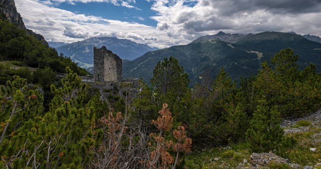
Fraele Towers

Standing 1,930 metres above sea level, they can be seen from the road that goes from Bormio to Livigno
Fraele Towers

From the rolling Moscato hills to Lake Endine

From the rolling Moscato hills to Lake Endine

Winter sunrise on the Corno San Colombano

Suggestive itinerary in Alta Valtellina
Winter sunrise on the Corno San Colombano

From Tartano to the Scima de Cavisciöla

Along hike with a fair amount of development and elevation gain. Not too demanding, but still requiring a good level of physical preparation and ability to assess snow conditions, in short sections on steep slopes. A solitary route immersed in enchanted places and directed toward a peak to which the official maps do not even give a name, but which the locals call in dialect "Scima de Cavisciöla."We are in Tartano (Sondrio). From the square we reach the contrada Biorca where we leave the car in a large parking lot. With negligible inclines, proceed southwest along the dirt road on the right of the stream, corresponding to path 113 that leads to the Pedena Pass. After about two kilometers you reach contrada Barbera, on the opposite side of contrada Bagini.Continuing straight ahead you enter the Budria valley. After another easy stretch of about two kilometers the valley ends and you are faced with a high rock barrier. You go around it by standing to the right on a steep, winding path on the slopes of Mount Pedena. Attention should be paid to snow conditions in some steep couloirs. You reach a scenic balcony of pastures near the Saröden huts (1,976 m) below the Pedena pass saddle (2,234 m).You head eastward to the narrow notch of the Bocchetta di Lago (2,202 m), after passing the Pizzo del Vento (2,235 m). At the summit of Mount Tartano (2,292 m) enjoy an excellent descent to the plateau of the Sona Alta cheese factory. From there, climb up to the saddle of the Orobic ridge that separates the provinces of Sondrio and Bergamo. Continue to the branch-off that leads east to the Lemma peak (2,348 m) and the Val Lunga di Tartano and south to the Siltri peak (2,175 m) and the Val Brembana. The final summit is called in dialect "Scima de Cavisciöla" or Western Lemma (2,266 m), although the peak is listed but not named on Military Geographical Institute cartography. It is located about 200 meters northeast of the better-known Pizzo Rotondo (2,237 m).The descent is along the Lemma valley, skirting in the final part the road alongside the Tartano stream until reaching the bridge at Barbera locality and continuing to the car on the initial route.  
From Tartano to the Scima de Cavisciöla

The two valleys of Cima Piazzi

This fairly challenging loop will take you through and get to know Val Cardonè and Val Lia: the two striking valleys in which Cima Piazzi, a mountain group in the Western Rhaetian Alps, located in the municipality of Valdidentro, is set. Drive past Bormio (Sondrio) and, after about 10 kilometers, arrive at the gates of Isolaccia (municipality of Valdidentro). Before crossing the bridge over the Viola stream, however, turn left reaching the sports field, where you can park. If you buy a ticket, you can instead continue by car to the locality of Pian di Astele (1,661 m). From this point the trail begins. Walking along a carriage road, you pass Madonna di Presedont (1,760 m), where you can see a pretty little chapel dedicated to the Madonna and the work of the Alpine troops.At a first fork in the road, continue to the right, toward the beautiful Cardonè valley, climbing to the huts of the same name at 1,986 meters. The signs to follow are those for the Ferrario and Cantoni bivouacs.Leaving the dense Conte forest behind you, at around 2,200 meters, the trail bends left and you will soon reach the Ferrario bivouac (2,350 m). We find ourselves in a magnificent area with breathtaking views and full of small lakes and streams fed by the melting glaciers of Cima Piazzi. Signs indicate the Cantoni bivouac, which you will reach after climbing a steep scree slope at the foot of the north face of Cima Piazzi. After a break to regain your energy, you will take the trail again and follow an easy, well-marked ridge trail to the Lia valley and the Boron alp. A scenic traverse will give you strong emotions in this section, completely immersed in nature, and then you will definitely lose altitude until you reach the alpine pasture. Some difficulty may be encountered in crossing the stream that enters the plain at around 2,115 meters. Better to follow the signs of a path that rises on the left leading to a small bridge. Cross the stream to reach the Boron alp (2,057 m) and the alp of the same name, a little gem in the middle of a wide pasture plain with shrub meadows, where it seems that time has stopped and where you can indulge in moments of relaxation. In about 1 hour 40 minutes you will return to the parking lot where you left your car, thus finishing this beautiful loop trail.
The two valleys of Cima Piazzi

Concarena, Gavia and Mortirolo: adventures on foot and by bike

The wildest side of Valle Camonica: from gorges for experts to the uphill hairpin bends that have written the history of the Giro d’Italia
Concarena, Gavia e Mortirolo: avventure a piedi e in bici

Mountains with ancient history: Valle Camonica

These mountains guard a World Heritage Site and offer nature holidays spent climbing, walking and pedalling   ExcursionsThe Valle Camonica is a wide, level valley in the central Alps. Crossed by the River Oglio, dominated by the Adamello mountain range, the valley is home to one of the world’s biggest collections of prehistoric rock art, the first site in Italy to be added to the list of UNESCO World Heritage sites. This area, with its many lakes, mountains, nature parks and immense landscapes, takes visitors back ten thousand years on a journey in time from the Mesolithic period to modern day. 5 mountain refuges on a circular route of Val MalgaA lovely one-day trail from Ponte del Guat (Guat bridge) in Val Malga takes hikers across the valley, discovering the welcoming mountain refuges of Valle Camonica Premassone, Tonolini, Baitone and Gnutti. The latter marks the start of an alpine trail that then leads up to the top of the Adamello. The Val Malga hike calls for some care on the stretch between the Gnutti and Baitone refuges and can be completed in 4 hours. Meanwhile, those preferring a hike lasting several days can follow the Alta Via dell'Adamello (Path/Sentiero no. 1), a wonderful trail, but only for fit hikers carrying all the equipment needed for high alpine routes. It includes in fact some rather exposed via ferratas (with fixed ropes, ladders, etc.). This route goes from Breno to Edolo and must only be undertaken by very expert hikers or with mountain guides. Each stage and each mountain refuge are starting points for short-medium hikes. The route can however also be enjoyed as one-day hikes, thanks to paths that link it with the valley bottom. Three-day Glacier hikeThe Adamello also offers the chance to enjoy the experience of a hike to the glacier. The Pian di Neve is a hikers’ dream because on clear days it allows amazing views reaching as far as Monte Rosa. Mountaineering fans can, on the other hand, test their skills along the skills along the Sentiero dei Fiori, a panoramic ferrata that ensures incredible views, suitable for experienced hikers.. The Oglio cycle pathFrom gentler walks to hikes uphill or along the trails and steep downhill unmade paths:discovering Vale Camonica by bike is spectacular. A cycle and pedestrian path starts at the Passo del Tonale pass, linking no fewer than 280 km of paths along the Oglio riverbanks and winding through the varied landscape of the valley, until it comes to the banks of Lake Iseo and through the Franciacorta vineyards. For keen mountain bikers,the Adamello Bike Arena offers more than 500 km of trails between the Valle Camonica and Va di Sole valleys, even entering the Stelvio and Adamello nature parks. The Passo del Tonale also has downhill and free-ride trails. Bienno, one of Italy’s most beautiful villages In Biennio, which belongs to the Club de I Borghi più belli d’Italia (“The most beautiful villages in Italy” club) visitors get a chance to relive a medieval atmosphere. Walking down its streets, they can see characteristic houses, towers and noble buildings, visit the Fucina Museo (Forge Museum) with its impressive waterpowered trip hammer and the (also water-powered) mill with adjacent museum of country life. A must-visit is the church of Santa Maria Annunciata, which still has beautiful frescos by Romanino, one of the most important painters from the Lombardy school and by the local artist Pietr da Cenno and his atelier.    Highlights1. Art. Worth a visit are the Pieve di San Siro church and the Monastero di San Salvatore in Capo di Ponte, both evidence of Romanesque architecture in Valle Camonica, and the Shrine to the Via Crucis in Cerveno with the Sacro Monte, or Sacred Mountain. 2. History. Valle Camonica, also known as Valle dei Segni, or the Valley of Signs, conserves a huge heritage of rock engravings. The Naquane National Park in Capo di Ponte and the MUPRE (National Museum of Prehistory) in Valle Camonica are both must visits. There are other parks in Dafro Boario Terme, Ceto, Cimbergo, Paspardo, Sellero, Sonico and Ossimo. 3. Sport. Renowned as an active holiday destination in both summer and winter, Valle Camonica has plenty to offer (hiking, MTB and road bike paths, cycling tourism, climbing, skiing, snowboarding, snowshoe walking and much more) with Ponte di Legno - Tonale,Borno, Montecampione and the Aprica mountain pass. 4. Food and wine. Foodies should check out the local dairy products, especially Fatulì (a Slow Food Presidium), a smoked goat’s cheese made with raw milk from the Bionda dell’Adamello goat, which can be tasted in the mountain refuges in Val Saviore and Silter Doc, a mountain cheese made with raw cow’s milk. 5. Events. In June, the Fiera della Sostenibilità della Natura Alpina is a sustainability fair organised by the Valle Camonica Mountain Community – Adamello Park. A must-visit is the Market-Exhibition in Bienno, with over 200 exhibitors from all over Italy and stalls with typical traditional valley dishes. Finally, the “Del Bene e del Bello” exhibition of cultural heritage.
Montagne di storia antica: la Valle Camonica

Path of the Charcoal Kilns

I The Charcoal Kilns Path is a circular hiking route of approximately 13.53 kilometers that starts from S. Albano, follows a stretch of the Nizza stream up to its sources, passes through the village of Oramala, Pian del Re, then descends near the Oratory of San Giulio in Poggio Ferrato, reaches the "Acqua d'Uovo" chapel in Molino Cassano, the hamlet of Cassano Superiore, and ends back at S. Albano, where it began. From the parking area, after the S. Albano cemetery, you take the dirt path that runs along the banks of the Nizza stream. At first, you will encounter a sulfur spring, and later a brief detour leads to the "Partisan Cave," a cavern that bears witness to the dramatic moments of the Resistance in Val di Nizza. Returning to the main path, after a short distance, you arrive at the "Madonna del Turista" shrine, created in the 1970s by the Pavia sculptor Vittorio Grilli. When you reach the ford of the Nizza stream, the path continues along a route bordered by badlands—rocky walls eroded by the elements, creating a spectacular landscape. Further ahead, a small sulfur spring gushes, accompanied by a stone bench for those wishing to rest. After passing the Nizza spring area, you cross the "Eagle Path" coming from the "Castello di Verde" and leading to Oramala. Here, you need to take a detour and keep right until you reach a forest clearing, created long ago by humans to make way for the "Charcoal Kiln," a technique used to turn wood into charcoal, as explained by the plaques located on-site. Returning to the main path, you continue until you pass the ruins of "Riassa," then reach the provincial road Varzi - Val di Nizza. Continuing along the asphalt without deviations, you can quickly reach the village of Oramala, with its 11th-century castle. The ancient village, once classified among the most beautiful in Italy, and the Oratory of the Nativity of the Virgin Mary, dating back to the 14th century, are also of tourist interest. Returning from Oramala on the main route, you can choose an alternative path that descends to Cassano Superiore. This section offers picturesque views of Oltrepò, including the Montalto Pavese Castle. Following the main itinerary, you reach the lower plain of Pian del Re, where you can admire various centuries-old chestnut trees of unique shapes and sizes. In the same plain, there is still a pit that was used to build the "buried charcoal kiln," another technique used by the charcoal makers to produce charcoal. Climbing to the upper clearing, you can enjoy the entire arc of the Apennines, with Mount Penice on the left, followed by Cima Colletta, Lesima, Chiappo, Pian dell'Armà, Boglelio, and Giarolo. The equipped area at Pian del Re provides an opportunity for a break. After resuming the walk, you descend until you meet the Health Path. A brief detour leads to the Oratory of San Giulio, one of the oldest in Val di Nizza. Continuing along the main direction, you reach the "Cappelletta dell'Acqua d'Uovo" in Molino Cassano, where a small sulfur spring flows, dedicated to the memory of Robertino and Valeria Schiavi. From the sulfur spring, via the "ciaplera," an ancient stone-paved path, you reach Cassano Superiore, the junction point for the previously mentioned path variant. From this small and charming hamlet, you proceed to the concrete bridge crossing the Nizza stream, then into the village of S. Albano, and after passing the church with its "voltone," you reach the starting parking area. Equipment: hiking boots, rain jacket, trekking poles, camera, binoculars, water. It is recommended not to light fires, not to pick flowers, not to leave waste, and to respect animals. Recommended period: all year round, except for hunting days. Information: Cultural Association Friends of Poggio Ferrato poggioferratoass@gmail.com www.amicidipoggioferrato.com Tel. +39 333.7318669
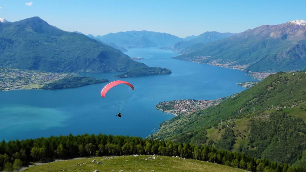
Alpine huts: Lombardy's best lookouts

A cool summer spent high in the mountains: 9 alpine huts, 2 bivouacs and a lodge to add to your Lombardy bucket list
Alpine huts: Lombardy's best lookouts

Rural settlements in Chiuro

Contrada Fancoli (Castionetto)

Clanezzo

    At the foot of Mount Ubione where the two rivers Brembo and Imagna converge, a few kilometres from Bergamo, lies the village of Ubiale Clanezzo.   In this strategic position at the entrance to the three valleys of Brembilla, Imagna and Brembana, stands the imposing castle surrounded by a charming park of centuries-old pine trees. It is an excellent starting point to head for the medieval village, the impressive Attone rough stone bridge and the Tibetan bridge leading to the Val Brembana trail.