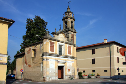
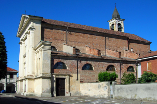
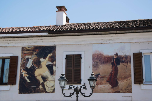
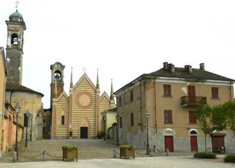
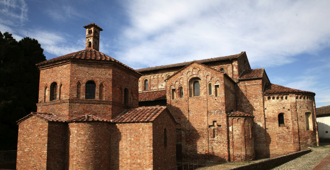
I found 446 results for Borghi

Nicorvo

Located between Vercelli and Mortara, Nicorvo is a small village immersed in the tranquility of the rice fields. Since 2006, a small group of volunteers has been taking care of pilgrims walking the Via Francigena who request hospitality. The parish church is dedicated to San Terenziano, the patron saint of the village. Consecrated in 1620, it has five altars, and several fine paintings can be seen, with the best being the one in the choir, which depicts the Blessed Virgin of the Rosary with the Child Jesus and Saints Dominic and Terenziano, Bishop. The painting is attributed to the Lanino school, which is thought to have worked in the area during the time the church was built. Another church very dear to the people of Nicorvo is the one they call the "Madonnina," dedicated to the Madonna del Patrocinio. Built in 1764, it assumed its current form in 1910 after several restorations. In the Parish House in the center of the village, 8 beds with mattresses are available (additional cots or mattresses can be added if needed). In the large hallway adjacent to the Parish House, bicycles can be parked sheltered from rain and indoors. For more information, you can write to: HOSPITALITY MADONNA DEL PATROCINIO AND SAN TERENZIANO email: ospitale.francigena.nicorvo@gmail.com facebook: Nicorvo Via Francigena @nicorvo.viafrancigena instagram: nicorvo.viafrancigena telegram: Ospitale Nicorvo tel. +39 371 5174578   Photo Di Alessandro Vecchi - Opera propria, CC BY-SA 3.0, https://commons.wikimedia.org/w/index.php?curid=10745415
Di Alessandro Vecchi

Tromello

Along the right bank of the Terdoppio stream, on the road connecting Pavia to Mortara, is the first stop of the Via Francigena.
Parrocchiale di San Martino

Travacò Siccomario

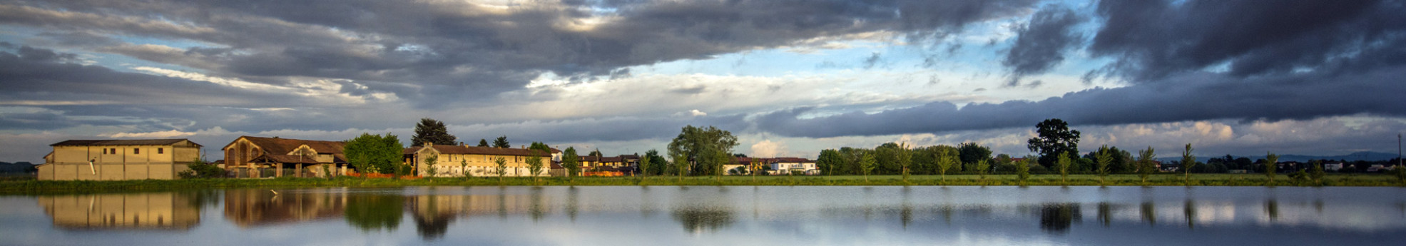
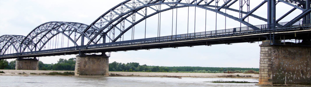
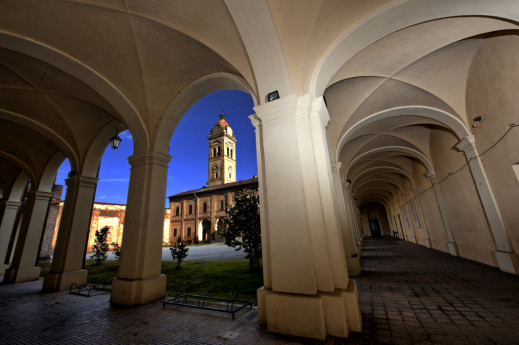
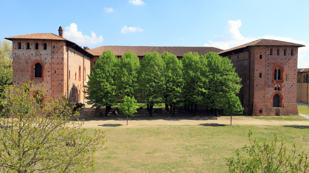
The municipality of Travacò Siccomario is located two kilometers south of Pavia, between the Ticino and the Po rivers, at their confluence. Together with the municipality of San Martino Siccomario, it is part of the territory called Siccomario. The Siccomario: Name and Territory in the Oldest Documents To address the issue of the origin of the rather unusual name of Travacò Siccomario, it is necessary to examine the two terms "Travacò" and "Siccomario" separately, based on the objective data derived from available archival documentation. From this, it is clear, as will be shown, that the imaginative interpretations suggesting that "Siccomario" comes from "sicut mare" or "siccum maris," as proposed by some chroniclers, are completely fanciful and unfounded. The same applies to those claiming the name derives from a category of swamp reclamation workers called "sighemarii." However, before delving into this, it is essential to clearly define the territorial extent of Siccomario. Geographical Delimitation of Siccomario The toponym "Siccomario," or more precisely the coronym (since it refers to a territory rather than individual towns or settlements), identifies a well-defined area. In 1330, the chronicler Opicino de Canistris describes the territory south of Pavia as follows: "The central part of the territory south of the city is bordered by three rivers. The Po at 5 miles, the Gravellone at 500 meters, and the Ticino along the city's walls themselves. The smallest part of the territory in this direction lies between the Ticino and the Gravellone, all belonging to the Municipality [of Pavia], and contains only meadows and the site of justice." This is the current Borgo Ticino. "The second part is full of excellent fields and produces abundant fruits of various kinds." This part, between the Gravellone and the Po, is called Siccomario ("Siccomarium appellatur"). Here, wines are produced that are not harmful in summer due to their low alcohol content, which, while not of high quality, still have their merits. Near the city, within Siccomario, there is a place commonly known as Terra Arsa, located one and a half miles from the city walls, where St. Martin of Tours was raised. There is another part beyond the Po, which is the true Oltrepò. Further details show that Opicino adds: "This city is surrounded, especially in Siccomario, by many gardens and orchards, and many pomarii," referring to orchards where apples are cultivated. From this description, it seems that Siccomario was the land between the Gravellone and the Po, with a part of it, where St. Martin's settlement was located during Opicino's time, being called "Terra Arsa." This fact is corroborated by medieval documents, where references to San Martino always say "San Martino in Terra Arsa," never "in Siccomario." Thus, the expansion of the term Siccomario to San Martino is certainly a more recent development. The Term "Siccomario" in the Oldest Documents The oldest document referring to the current Siccomario area is a donation made by Charlemagne to the great Monastery of St. Martin of Tours in 774, after he besieged Pavia and defeated the Lombards. In this document, although it deals with churches and lands located in Siccomario, the term "Siccomario" does not appear. At this time, and for several centuries afterward, the name "Siccomario" continues to be absent. However, the adjective "arida" is used, but not "terra arsa," which first appears in 909, in a document by Berengar I, which mentions "pratellos quinque" [five meadows] in a place called terra arsa, a meadow with a small grove. So, during this period, the name "terra arsa" is used, but the toponym Siccomario does not yet exist. After almost two centuries with no relevant documentation, in a document from October 2, 1099, we finally see the first mention of "Siccomario." The Abbey of St. Maiolo in Pavia, in fact, sells goods "in loco et fundo Sigemario at Pozzallo" ("Locus et fundus" is a term used to describe a small rural settlement, typically a village with its surrounding land). In any case, the most logical explanation is that "Sigemarius" is a Germanic personal name, well attested in Lombardy as early as the 8th and 9th centuries, probably of Frankish origin, although this cannot be stated with absolute certainty. Who this Sigemario was, why he had property in this area, and why his name was left behind is unclear. However, an interesting coincidence reinforces this interpretation: there was a Monastery in Pavia in the 9th century called "de Sigemario." This fact is enough to attest to the existence and circulation of this name. The Monastery "de Sigemario" was named as such because it was founded by someone named Sigemario. However, the exact location of this Monastery is not known, and by the 10th century, it disappears from the records. Thus, the most logical explanation is that "Siccomario" derives from a personal name that eventually became a toponym. The traditional explanation was that it came from "secco mare" (dry sea) until Olivieri, around 1930, proposed the interpretation linked to the name "Sigemarius." Olivieri was a prominent toponymist who wrote a dictionary of Lombard toponymy, and all subsequent scholars have adopted his interpretation. Thus, the name Siccomario, in the form "Sigemario," very similar to a personal name, first appeared in the 11th century, in 1099, and became firmly established from that time on. Other Important Documentary Evidence From this time onward, particularly starting in 1120, we have numerous documents related to the goods that the Abbey of St. Maiolo owned in this area, especially lands, which were granted, sold, and expanded through new purchases. Therefore, the history of this area is increasingly well documented. Let's look at them quickly. The first document after 1099 is dated 1120 and mentions a "clausura super fluvium Ticinum" (the "clausura" was a fenced-in area, usually a vineyard). "Super fluvium Ticinum" means "beyond the Ticino river." The document goes on to say "in loco et fundo Casellae qui dicitur in Sigemario prope Pozzolum." There is a whole series of documents that mention the Ticino and "loco et fundo Sighemario" with various specific places located within the Siccomario territory. Furthermore, in 1130, there is mention of lands "in Sigemario" being donated to the Church of St. Mary of Bethlehem. At one point, in 1171, a vineyard plot appears in "Sigemario vetulo," meaning the old Siccomario. This indicates the need to distinguish the old Siccomario from a new territory, which likely had not been previously named this way but was now recognized as part of the Siccomario. For the entire 12th century, we see a series of place names until 1180, when a new and interesting element of the landscape appears: "in loco et fundo Sigemario prope Ruptam." This is the first mention of the name "Rupta," which had never been attested before. In this regard, the testimony of the Anonymous of the 800s is interesting, as he states that the Rotta divides the Siccomario in half, with "terra arsa" (the territory of San Martino) on the left and the true Siccomario on the right. The Rotta thus separated Siccomario from "terra arsa." There is also a papal bull from 1187 for the Monastery of St. Agatha of Pavia, listing many properties scattered throughout Northern Italy. At one point, it mentions "prata omnia super Ticinum," meaning "all the meadows beyond the Ticino," but without specifying the location. Soon after, the same bull mentions "ad Sanctum Martinum in terra arsa campum unum," but still does not mention Siccomario. This document, although from 1187, likely copies an older document, possibly from before the 11th century, because it would have been impossible at this time to not mention Siccomario when discussing lands between the Ticino and the Po rivers. Still, in the same document, we find "Sigemario vetulo" (old Siccomario) and later "S. Maria di Siccomario," which, in 1187, is under the jurisdiction of the Monastery of St. Maiolo. Regarding the Term "Travacò" Regarding the term "Travacò," we can refer to Olivieri's "Dictionary of Lombard Toponymy" and the numerous commentators and scholars who reference it, indicating "travacca" as a structure used to reinforce a riverbank, which is particularly suitable given the nature of the area. The "travacca" would thus be an element used to reinforce a riverbank. In Lombardy, this is a common name, and there are farms named "Travacca," "Travaccò," etc. The accent on the final "o" is typical of other names that originally ended in "atum." Therefore, the name likely originated as "trabaccatum," meaning a place where a "trabacca" (reinforcement element) was built along a watercourse. Fonte: Comune di Travacò Siccomario

Parona

A small center of Lomellina, located between the territories of Vigevano, Mortara, and Cilavegna, Parona has about 2,000 inhabitants, spread over an area of 9.34 km² at an altitude of 113 meters above sea level (click here for the map of the town center). Parona is an ancient village that has transformed in just a few years from a rustic and somewhat "old" town into a modern, dynamic, and welcoming municipality. Over the years, the town’s economy has gradually changed: from being an agricultural center, it has slowly become a town of small artisans and entrepreneurs, as well as a residential area for the many workers employed in nearby Lomellina towns. Parona is redefining its identity, yet it remains a small, human-sized town immersed in countryside that creates ever-changing and charming landscapes, with unique features that deserve to be discovered. Notable is the Parish Church, dedicated to St. Peter the Apostle, rich in valuable frescoes. In the altar of the Madonna, within a beautiful golden wooden urn, there is a 1700s wax figure of the Baby Jesus (pictured here in a Christmas exhibition). This figure was placed in the Basilica of the Nativity in Bethlehem and laid down on Christmas Eve in the very spot where the shepherds worshipped the celestial infant. The church also houses the majestic painting "Tibi dabo claves" by the painter from Parona, Lorenzo Toma. The same artist created the fourteen panels of the Stations of the Cross along the central nave. Also characteristic is the Church of San Siro, no longer used for religious services, whose bell tower (pictured above) is considered a symbol of Parona, having been chosen as the emblem depicted on the packaging of the "Offelle di Parona." Parona also once had a Castle, home to several feudal families, of which little remains today. Among the notable architectural works, Piazza Nuova stands out (pictured here); inaugurated in 1989, it gave a new look to the town center. Despite these changes, the marks of Parona's rural past are still evident, reminding us of a not-so-distant time when daily life was hard but simple and genuine, with traditions passed down from father to son, of which the religious aspect was essential. A common thread that connected everyone was the language, the dialect, spoken by everyone, from the elderly to the children; this dialect is now almost extinct among the younger generations. To discover the rural past of the town, it may be interesting to visit the eastern part, where traces of Parona's rural world can be found, starting with the Santo Spirito mill, followed by nearby farms still in operation: the Cascina Castello, also called "Cascinino," and the Cascina Scocchellina (pictured), named after archaeological finds, "cocci," in the surrounding area. There is also Cascina Scoglio, which houses several marble sculptures inspired by rural mythology from the late 1920s, as well as frescoes depicting the four seasons. Along the state road to Vigevano, there's Cascina Naïna, now a restaurant, where, in addition to the decorations on the buildings, the chimneys are very similar to those in Vigevano’s Piazza Ducale. The traditional culinary aspects of the area are harder to find, although in recent decades, both in Parona, with the now-famous Sagra dell'Offella, and in other Lomellina towns, various events are held to rediscover and protect typical local products. From an environmental perspective, noteworthy are the Acqualunga Forest with the nearby Newborn Park and the Rampi Forest. In addition to the already mentioned Lorenzo Toma, there are other notable figures who were benefactors of our community in the 19th century and have linked their names to part of the history of our small town. Culturally, several literary works by local authors are worth mentioning: some research on our village by historians Mario Rampi and Angelo Gravanaldi, two poetry collections by Lino Negri and Paola Bellavite, a fairy tale published by Carla Masutti, and a publication for children ("Il mio paese") published by the Pro Loco, which every year donates copies to the children in their first year of elementary school. The municipal historical archive has also been fully restored. Finally, we cannot overlook the events organized by our Pro Loco throughout the year, first and foremost the aforementioned "Sagra dell'Offella" on the first weekend of October, whose first edition dates back to 1969. More recent, but equally attractive, are two other major events: "Parona téra böna," held on the first Sunday after Easter, and "Un paese per giocare," on June 2. The latest event organized by Pro Loco is a grand "Treasure Hunt." (Source: Proloco Parona www.parona-lomellina.it) Photo: Alessandro Vecchi / CC BY-SA (https://creativecommons.org/licenses/by-sa/3.0)

Olevano di Lomellina

Olevano di Lomellina is a small municipality in the province of Pavia, located in the region known as Lomellina, between the Po, Sesia, and Ticino rivers. It is a town with ancient origins, whose existence has always been tied to agriculture, which still remains the main activity today. The vast plain of Lomellina, where Olevano stands, stretches between the Ticino, Po, and Sesia rivers: "a strange, unsettling, and fascinating land that offers visitors vast spaces, great silences, and wide horizons, so rare in Italy." Here, everything has been built, transformed, and organized by man with infinite and centuries-old patience; by nature, this land of springs would be an impassable swamp: and indeed, it was such for centuries. Then, the monastic communities in the Middle Ages, the feudal colonization in the 1200s, and the great agronomic reforms introduced by the Sforza family, who experimented with rice cultivation in the second half of the 15th century, turned Lomellina into a mosaic of rich cereal fields. To serve this vast cultivation, a complex system of canals and ditches was organized, and typical closed-court farmhouses, characteristic settlements of industrialized agriculture in the Po Valley, were built. Today, the laborious cycle of rice cultivation, based on transplanting and cleaning the grain by the rice women (mondine), in fields previously planted with forage, with continuous crop rotation, is just a memory; fertilizers, herbicides, and mechanical means have greatly simplified the work cycle, which begins in April with leveling, flooding, and sowing the rice directly in the rice paddies, and ends in September with the harvesting, threshing, and drying of the grain. Even though the "singing" rice women have disappeared and the number of croaking frogs has greatly decreased, the Lomellina region still retains a fascinating, discreet charm in its vast, deep, and mysterious spaces, scattered between sky and water. In 2018, the Museum of Art and Agricultural Traditions was inaugurated. It collects the most significant objects from the Lomellina agricultural world from the 1800s to the 1960s. It is housed in a renovated rural building, once used as a stable and hayloft, located on Via Uberto de' Olevano, in front of the Medieval Castle. On August 15 and 16, during the feast of Saint Roch, the Sagra del Salam dla Duja is held, featuring the typical pork salami preserved under fat in terracotta pots. "La duja" is a clay pot in which salamis, made with pork, salt, and pepper, are dried and aged for about a month before being placed in the pot and covered with lard. SOURCE: MUNICIPALITY OF OLEVANO DI LOMELLINA Photo:  Solaxart - Preboggion - Milano 

Gravellona Lomellina

Town of Art, Nature, and Imagination

Rosasco

The municipality of Rosasco is located in the western Lomellina, not far from the left bank of the Sesia River. In Rosasco, rice cultivation gives its peculiar characteristics to a rural world that has written and continues to write the history of this territory. The environmental geography is therefore formed by a single morphological area, following a pattern in which the vast countryside is flat and uniform, with a dense network of ditches and canals delimiting the fields and various properties. The advantages derived from a rational distribution and use of water are accompanied by those provided by new, increasingly efficient and sophisticated machines: the farmer has reached excellent production levels thanks to the intense mechanization and modernization of his farms, acquiring entrepreneurial and technological skills that allow him to maintain a high competitive capacity. The generational turnover has seen young farmers increasingly focused on innovation and experimentation. The "Cerchiara"It is a vast swampy basin, extending over about 20 hectares in the territory of Rosasco and an equally large area in the nearby locality of Celpenchio, from which the heronry takes its name. The heronry represents a splendid and unspoiled natural park, where, alongside the lush variety of plant life, numerous species of birds and other animals can enjoy an extraordinary habitat with guaranteed hospitality. The Castle of RosascoBuilt towards the end of the 9th century, the Castle of Rosasco is one of the oldest military structures in Lomellina. It is a vast fortified system, still recognizable in its perimeter, although it suffered a severe devastation in 1630 by the French led by Crequi, followed by the complete destruction of the walls by the Savoy troops in 1643. Today, only two towers remain visible and very well preserved, thanks to careful restoration work. One tower is the impressive "Torre del Consegno" (so named for its use, during the Napoleonic period, as a place to call the young men of the area to enlist), which faces the east side of the village square, and the tall, slender Ghibelline tower, with an unusual rectangular shape, rising 25 meters in the highest part of the historic center. Both towers are open to visitors: in particular, from the top of the second, one can enjoy a stunning view of Rosasco and the surrounding territory. Within the ancient perimeter of the Castle, facing the large area of the churchyard, which gently slopes down with its cobblestone path toward the center of the village square, stands the imposing Parish Church, built in 1496 on the foundations of the original Chapel of the Court. The building, with a rectangular layout and two side chapels, incorporates one of the medieval towers connected to the Castle on the southeast side; inside, the spaces are marked by a double row of powerful cylindrical brick pillars, giving the environment a sense of strength and solemn severity. Among the numerous works of art preserved inside, a splendid oil painting on wood by Bernardino Lanino (late 16th century) stands out on the right wall; also worthy of mention is a fine wooden Crucifix from the same period and, in the sacristy, a significant fresco from an earlier time of considerable quality. The entire building was restored and secured with a series of appropriate conservation interventions between 1986 and 2005. It is dedicated to Santa Maria and the patron saint of Rosasco, Saint Valentine. The Church of San GiuseppeAlso facing the same churchyard is the Church of San Giuseppe, built during the 17th century. It is characterized by a single nave with a presbytery and a semicircular apse, and a tall bell tower. It belonged to the "Confraternity of San Giuseppe," active until 1870. Over the years, it has undergone several alterations, but these have not taken away the subtle charm that makes it so different from the nearby Parish Church.

Pieve del Cairo

The municipality of Pieve del Cairo lies at the borders of Lomellina, separated from Piedmont by the waters of the Po River. A town with ancient agricultural traditions, it has been affected by the crises that have troubled agriculture, leading to the progressive depopulation of the municipality.The ancient settlement of Cairo, of Celtic-Ligurian origin, arose at the confluence of the Tanaro River into the Po, along the road that connected "Julia Derthona" (Tortona) to Tromello and Novara, leading toward Switzerland. This road, initially drafted during the Punic Wars, was extended to the Simplon Pass by Emperor Septimius Severus in 210 AD. Source: Municipality of Pieve del Cairo THE BECCARIA CASTLE OF PIEVE DEL CAIRO (13th - 18th century)One of the largest in the province of Pavia, Beccaria Castle, which still carries the name of one of the first families who lived there, stands out in the Lomellina and Pavia landscapes for its massive size. It is an example of great historical and architectural interest because, through the layering of styles, from the original remains of the 12th century to Visconti constructions, from Baroque innovations to Neoclassical features, it represents a magnificent example of architectural languages that have harmoniously fused over the centuries, within the rich context of the Lomellina countryside. Source and photo: FAI Fondo Ambiente Italiano
Castello Beccaria Pieve del Cairo

Mezzana Bigli

The municipality of Mezzana Bigli is located in southern Lomellina, a short distance from the left bank of the Po River, near the confluence of the Agogna River. Amid the tranquility of the Lombard countryside lies Cascina Erbatici, a large agricultural complex now used as a conference and event center. WHAT TO SEE The parish church dedicated to Saint John the Baptist was built in the early 19th century in Neoclassical style and was renovated by Frascaroli in 1970. The restoration focused on both the architectural structure and the conservation of paintings by Raggi (in the apse area) and Gambini (in the naves). The splendid Baroque-style high altar, upon which stands a highly valuable wooden crucifix, was commissioned by Countess Anna Confalonieri and made from the finest marbles. In the presbytery, two paintings depicting the stories of Saint John and Saint Peter Martyr can be admired. In the naves, on the right side, there is a precious altar with marble inlays, housing a statue of the Virgin Mary. On the left, the baptistery features a stone cover supported by marble columns. Notable elements include the 18th-century walnut sacristy and the Lingiardi organ. The church in the hamlet of Casoni Borroni, dedicated to Saint Mary of the Assumption, was commissioned by Anastasia Biglia in the late 16th century. It was later enlarged and renovated by Fulvia Biglia in the 18th century. A large painting in the choir, depicting a majestic image of the Assumption of the Virgin, is of particular interest. It is attributed to Gaudenzio Ferrari (1475–1546). Though difficult to confirm with certainty, as Callegaris suggests, the attribution is not entirely unfounded for several reasons: first, a work by Ferrari is preserved in the church of Silvano Pietra, and it is well known that his students worked in Lomellina. Additionally, the presence of prominent Milanese families in the region may have brought valuable artworks to rural churches. The parish church in the hamlet of Balossa Bigli was commissioned by Marquis Crivelli in 1820, expanding an oratory that had existed since 1752. Originally built with a single nave, it underwent several renovations and expansions over the years. In 1895, a sacristy annex was added to the left of the presbytery; in 1905, the right nave was added and the old sacristy was enlarged. Finally, in 1922, the left nave was completed.

Lomello

In the 6th and 7th centuries Lomello was the occasional residence of the first Lombard kings and its royal status was confirmed in the imperial period when the Lomello counts began to extend their rule to the surrounding areas. The Collegiata di Santa Maria Maggiore complex and the Battistero di San Giovanni ad Fontes, built in the heart of the Lombard kingdom with its ancient baptismal font in hexagonal shape and painting decorations dating to the 7th century, are both of great historic, artistic and architectural interest.
Lomello

Breme

A small medieval village rich in history at the confluence of the Po and Sesia rivers in Lomellina

Vigevano

A Renaissance Gem in the Heart of Lomellina