- Itinerari
From Romagnese to S. Margherita di Staffora

The route connecting Romagnese to Santa Margherita di Staffora features two rather long climbs, with a total elevation gain of about 1000 meters.
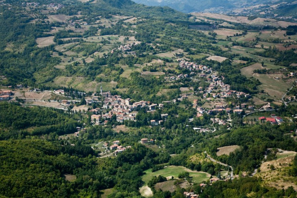
Romagnese is located in the Upper Val Tidone, in the mountainous area of Oltrepò Pavese, easily accessible by following the old SS412 road. It is not far from the Passo Penice. Romagnese lies at an altitude of 650 meters, a prestigious summer and winter resort due to its healthy air. According to tradition, rooted in legend, the ancient village of Romagnese (Castrum Romaniense) is said to have originated from a camp of Roman legionaries who fled after their defeat in the Battle of the Trebbia River at the hands of Hannibal's troops during the Second Punic War (218 BC).
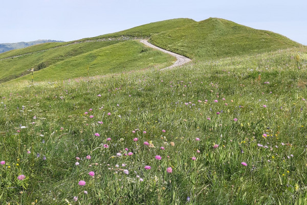
Leaving Romagnese, the route climbs up to the scenic Strada di Costa d’Alpe, from which it descends to Piano Margarino and Menconico. A second, less demanding climb leads to Costa Roncassi, and the final 3 km of descent take you to Santa Margherita di Staffora.
The itinerary passes through the Monte Alpe Nature Reserve and the village of Menconico.
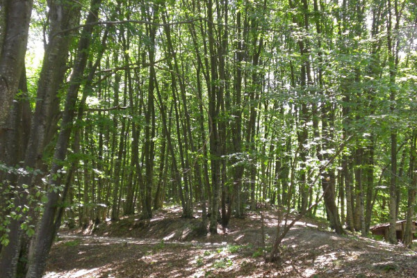
Monte Alpe is interesting both for its chestnut groves and grassy areas, as well as for the presence of artificial conifer plantations (black pine, Scots pine, and larch), which were almost entirely destroyed by fire and later subjected to restoration efforts to promote spontaneous vegetation. There are also petrifying springs that form travertine, particularly valuable for the protection of European habitats.
The history of Menconico is closely tied to that of Monte Penice, located near the boundary of the municipality. The toponym Penice, formerly known as "Mons Conicus," is thought to have given the village its name, which means "the place of large rocks." It is said that a pagan temple once stood on the summit of Monte Penice. The land was gifted to Saint Columbanus by Aldovald, son of King Agilulf. Tradition holds that Queen Theodolinda passed through here in 613 on her way to Bobbio to visit Saint Columbanus.
The route ends in the municipality of Santa Margherita di Staffora, at 546 meters above sea level, in the mountainous area of Oltrepò Pavese, in the upper Staffora valley.
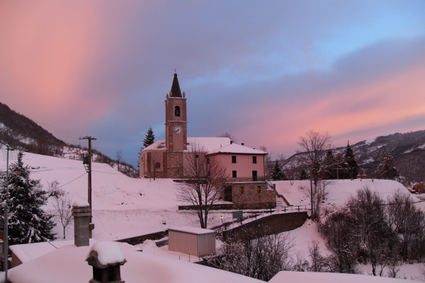
Above the fortress of Santa Margherita, the church is clearly visible, offering a panoramic view of much of the valley. On the side, partially hidden from the provincial road, the remains of the manor/castle, once owned by the Malaspina marquises, are still visible.
Mostra cosa c'è nelle vicinanze:
